Interactive Amazon map could help protect rainforest
-----------------
A new online tool for studying land-use in the Amazon could help decision makers and researchers design incentive-based approaches for managing the region’s ecosystem services.
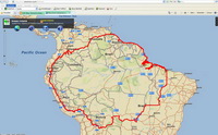
Developed by CIAT and the World Agroforestry Centre (ICRAF), the Amazon Initiative Interactive Map Server, is the first freely-available web-based application of its kind. By using satellite imagery and digital geographic information, it allows users to select specific areas of the Amazon and retrieve information about population density, biodiversity, land cover, and rates of forest loss.
Crucially, the application helps users to estimate the opportunity cost of Reducing Emissions from Deforestation and Forest Degradation (REDD) in a user- defined area, placing a monetary value on forest conservation. This can be used to calculate the cost of carbon offsetting.
According to Jan Borner, an agricultural economist for the Amazon Initiative: “During the last three years we have been involved in several studies dealing with the biophysical and socio-economic determinants of effective ecosystem service management in the Amazon for both governments and international donors. This tool provides access to the data and basic methodological approaches used during this work. We encourage user feedback from our online forum in order to better tailor the application to their needs.”
 Quickstart guide: upon entering the site, users can select one of four options. First-time users should read the Online Help before they get started. They can also visit the Amazon Initiative online forum discussing the tool. A third option allows users to provide feedback to the Amazon iInitiative and the developers of this application by filling out a short survey. Finally, users can dive straight in and get started using the application.
---------------
